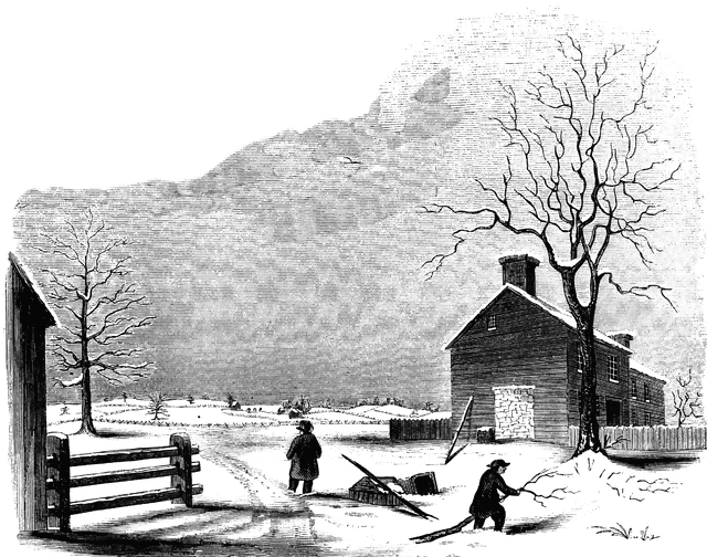
Princeton battle-ground
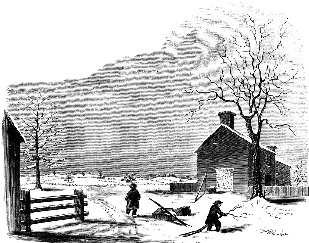
“View of the battle-ground near Princeton. This view, looking north, is from the carriage gate of Mr. John Clarke, owner of the house in which General Mercer died, which is situated about seventy rods from the Trenton turnpike. That dwelling is represented in the foreground of the picture, on the extreme right. The distant view includes almost the whole field of action. Near the center of the picture, over the head of the dark figure, is seen the house of William Clark, and his out-buildings. The barn, a little more to the left, with a tree in front, is upon the spot from whence Mercer rushed forward to the hedge-fence. That fence was upon the line of the present turnpike, denoted in the sketch by the fence passing down the slope beyond the large tree on the extreme left. The ‘high ground’ for which both parties were aiming, to secure advantage, is seen in the extreme distance. The dark spot between the tree in the second field and the barn denotes the spot where Mercer fell. The house of William Clark, in the distance, is about a quarter of a mile from the one in the foreground, where Mercer died. The hollow between the two houses was the space between the belligerents when Washington advanced to the support of Mercer. The place of conflict is about a mile and a quarter south of Princeton. The turnpike passes directly through it."—Lossing, 1851
Keywords
American Revolution, battleground, battle ground at princeton, battle-ground, princeton, mercer's death, where mercer diedGalleries
1763-1788 American Revolution PlacesSource
Benson J. Lossing, The Pictorial Field-Book of the Revolution (New York: Harper & Brothers, 1851)II:236
Downloads
2400×1893, 2.0 MiB
1024×807, 302.1 KiB
640×504, 127.4 KiB
320×252, 34.3 KiB