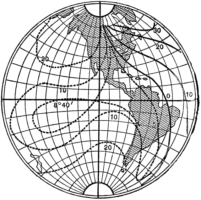
Isogonic Lines of Earth
| View Cart ⇗ | Info

“The magnetic poles of the earth do notc oincide with its geographical poles and, condequently, in some places, the magnetic needle does not point ot the geographical north. The angle that the axis of a compass-bneedle makes with the geographical meridian at any place is called the declination or variation of the needle at that place...Lines drawn through places on the earth where the declination is the sam are called isogonic lines, as shown.” -Avery 1895
Galleries
MagnetismSource
Elroy M. Avery School Physics (New York: Sheldon and Company, 1895) 475
Downloads
2408×2400, 986.4 KiB
1024×1020, 179.7 KiB
640×637, 100.0 KiB
320×318, 37.4 KiB