Topography
| View Cart ⇗ | Info
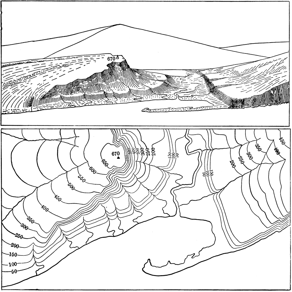
The top image is a sketch of earth contours. The bottom image is that land translated into a topographical map.
Galleries
TopographySource
Charles R. Dryer Lessons in Physical Geography (New York, NY: American Book Company, 1901)
Downloads
2400×2397, 870.2 KiB
1024×1022, 156.9 KiB
640×639, 75.3 KiB
320×319, 25.4 KiB