Clipart tagged: ‘map’
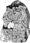
A Babylonian Map of the World
"A tablet of dark brown clay, much injured, dating from the 8th or 7th century B.C. The two large concentric…
Sebastian Cabot
Italian navigator and cartographer. Sebastian Cabot (c. 1474 – c. December 1557) was an Italian explorer,…
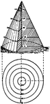
Contours of a cone
The contours of a cone are circles of different sizes, one within another, and the same distance apart,…
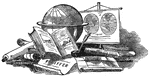
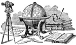
Globe
An illustration with multiple instruments used for navigation. These items include a globe, compass,…
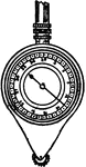
Map measurer
"By use of an instrument called a map measurer, set the hand on the face to read zero, roll the small…
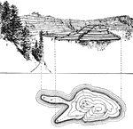
Elevation map
"The nearer the contours on a map are to one another, the steeper is the slope, and the farther the…
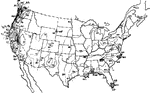
Map of rainfall in the United States
Map of the continental United States, illustrating the rainfall in different areas.
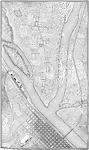
Topographic Map
An illustration of a topographic map using conventional symbols commonly used in drafting and map drawing.
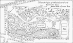
Topographic Architect Map
An architect's landscape map of a Texas Park illustrating a combination of conventional topographic…
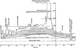
Topographic Profiles
A profile is cross sectional view, or side view, showing elevation at a given distance. The illustration…
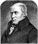
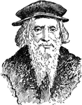
William Smith
William Smith (March 23, 1769 – August 28, 1839) was an English geologist, credited with creating…