|
|
|
| Maps > Europe > Italy |
Historic and contemporary maps of Italy, including political and physical maps, early empires, WWI, city plans, and battle plans.

|
Rome and Carthage,
264–241 B.C. |

|
Rome and Carthage on the eve of and during the first Punic War,
264–241 BC |

|
Italia Up to the Time of Augustus,
27 BC |
|
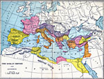
The Roman Empire Under Augustus,
27 BC to AD 14 |

|
Map of Italy,
275 B.C. |

|
Rome and South Italy,
282 BC |

|
Roman Power After the Samnite Wars,
290 BC |
|
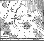
Early Latium,
338 B.C. |
|
Italy,
343–263 BC |

|
Rome and the Samnites,
343–290 BC |
| First | Previous | Next | Last |
| Maps > Europe > Italy |
Maps ETC is a part of the Educational Technology Clearinghouse
Produced by the Florida Center for Instructional Technology © 2009
College of Education, University of South Florida