Maps Site map
  Maps > Europe > Regional Maps >Western and Central Europe
Site Map  

  Record   81   to   90  of   121

Regional European maps of the Western and Central Europe region from the Maps ETC collection. This includes physical and political maps, early history and empires, WWI maps, climate maps, relief maps, vegetation maps, population density and distribution maps, cultural maps, and economic/resource maps.

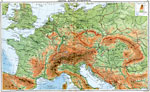
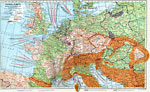
Central Europe - Orographical, 1915
A map from 1915 of western and central Europe showing general land elevations and water depths of the region. The map uses color–contouring to show elevations from sea level to above 9000 feet and water depths to below 1000 fathoms. The map sho...

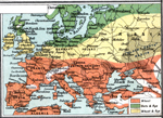
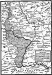
Granaries of Europe, 1915
A map from 1915 of western and central Europe showing the principal grain producing regions. The map is keyed to show the regions of primarily wheat, regions of oats and rye, and regions of wheat and rye....

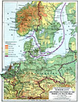
Germany and other Countries on the North and Baltic Seas, 1916
A physical and political map of Germany and other countries on the North and Baltic seas in 1916, including Denmark, Netherlands, Belgium, and portions of Norway, Sweden, Finland, and Russia. The map shows the boundaries of the German Empire at that ...

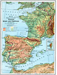
France, Spain and Portugal, 1916
A physical and political map of France, Spain and Portugal from 1916, showing country borders and capitals, major cities and ports, principal railways and ferry routes across the English Channel, as well as major rivers, lakes, coastal features and m...

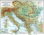
Southeastern Europe, 1916
A political and physical map of Austria–Hungary, Italy, Switzerland and the Balkan countries in 1916. This map shows country boundaries, major cities and capitals, principal railroads, rivers, mountains, and is color–coded to show elevati...

German Concessions After World War One, 1919
A map from 1919 of the Alsace and Lorraine regions after World War I. In accordance with the terms of the Treaty of Peace, Alsace, and Lorraine were restored to France; the Saar Basin was taken out of German control for fifteen years; Luxemburg cease...

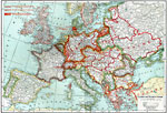
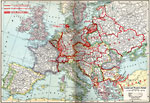
Central and Western Europe, Post WWI, 1920
A map of Central and Western Europe after the Treaty of Versailles at the end of WWI. The map shows the lack of defined borders before they were finalized in treaty negotiations, and includes railroads, canals, shipping routes, major cities and capit...

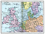
British Isles in Relation to Europe, 1920
A map from 1920 of the British Isles in relation to the Continent. This map shows principal railways and steam ship routes with distances between ports in 1920....

Economic and Commercial Map of Central Europe, 1920
An economic and commercial map of Central Europe in 1920 showing primary products, major ports and trade centers, railroads, navigable rivers, and steamship routes. Import and export information is provided. The map also shows general land elevations...

Central and Western Europe, 1920
A map of Central and Western Europe after the Treaty of Versailles at the end of WWI. The map includes railroads, canals, shipping routes, major cities and capitals, and the country boundaries established by the Treaties of Versailles, proposed bound...

First Previous Next Last


  Maps > Europe > Regional Maps >Western and Central Europe
Site Map  

Maps is a part of the Educational Technology Clearinghouse
Produced by the Florida Center for Instructional Technology © 2009
College of Education , University of South Florida