|
|
|
| Maps > Europe > Regional Maps >Western and Central Europe |
Regional European maps of the Western and Central Europe region from the Maps ETC collection. This includes physical and political maps, early history and empires, WWI maps, climate maps, relief maps, vegetation maps, population density and distribution maps, cultural maps, and economic/resource maps.
|
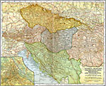
Southeastern Europe,
1920 |
|
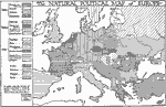
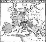
Natural Political Map of Europe,
1921 |

|
Expansion of Christianity,
1st Century.–14th Century A.D. |
|
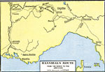
Hannibal's Route from the Rhone to the Apennines,
218–217 BC |

|
Hannibal's March to Italy,
219–216 BC |
|
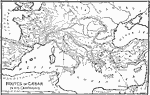
Routes of Caesar,
58–44 BC |
|
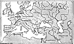
The Enemies of the Roman Empire,
753 B.C. |
|
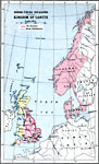
Kingdom of Canute — Norse–Viking Invasions,
995 to 1035 |
|
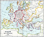
Europe at the Time of the Crusades,
A.D. 1189 |
|
Europe,
A.D. 500 |
| First | Previous | Next | Last |
| Maps > Europe > Regional Maps >Western and Central Europe |
Maps
is a part of the
Educational Technology Clearinghouse
Produced by the
Florida Center for Instructional Technology
© 2009
College of Education
,
University of South Florida