|
|
|
| Maps > Globes & Multi-Continent > Regional Maps >Regional Mediterranean |
Regional Globes & Multi-Continental maps of the Regional Mediterranean region from the Maps ETC collection. This may include physical and political maps, early history and empires, climate maps, relief maps, vegetation maps, population density and distribution maps, cultural maps, and economic/resource maps.
|
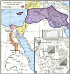
Chaldean Ascendency In Western Asia,
3800 B.C. |
|
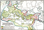
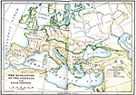
Expansion of Roman Empire from the Death of Caesar to the End of the Two Centuries of Peace,
44 B.C. to A.D. 167 |
|
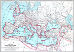
Roman Empire,
509 BC to AD 476 |
|
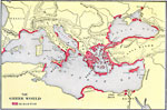
The Greek World,
550 BC |
|
The Migrations of the Germans,
5th Century A.D. |
|
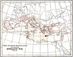
The Roman Dominions at the end of the Mithradatic War,
64 BC |
|
The Roman Empire,
753 B.C. to 117 A.D. |
|
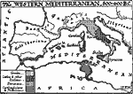
The Western Mediterranean,
800–600 BC |
|
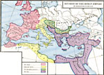
Division of the Roman Empire by Diocletian,
A.D. 292 |
|
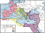
The Roman Empire in the Time of Valentinian I,
A.D. 364–375 |
| First | Previous | Next | Last |
| Maps > Globes & Multi-Continent > Regional Maps >Regional Mediterranean |
Maps
is a part of the
Educational Technology Clearinghouse
Produced by the
Florida Center for Instructional Technology
© 2009
College of Education
,
University of South Florida