|
|
|
| Maps > Globes & Multi-Continent > Regional Maps >Regional Miscellaneous |
Regional Globes & Multi-Continental maps of the Regional Miscellaneous region from the Maps ETC collection. This may include physical and political maps, early history and empires, climate maps, relief maps, vegetation maps, population density and distribution maps, cultural maps, and economic/resource maps.
|
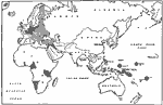
Germany and Possessions Before and After Armistice,
1919 |
|
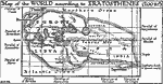
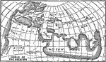
World According to Erathosthenes,
200 BC |
|
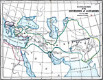
Kingdoms of the Successors of Alexander,
300 BC |
|
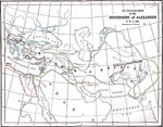
Kingdoms of the Successors of Alexander,
300 BC |
|
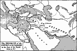
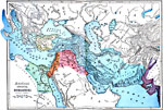
Breakup of the Empire of Alexander,
300 BC |
|
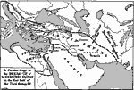
Further Breakup of Alexander's Empire,
300–250 BC |
|
Divisions of the Empire of Alexander,
301 B.C. |
|
World of the Ancients,
3100–509 BC |
|
Ancient Oriental Monarchies,
3150 BC |
|
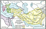
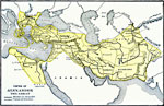
Map of the Empire of Alexander the Great,
323 BC |
| First | Previous | Next | Last |
| Maps > Globes & Multi-Continent > Regional Maps >Regional Miscellaneous |
Maps
is a part of the
Educational Technology Clearinghouse
Produced by the
Florida Center for Instructional Technology
© 2009
College of Education
,
University of South Florida