Maps Site map
  Maps > North America > Complete Maps
Site Map  

  Record   41   to   50  of   90

Historic and contemporary maps of North America, including physical and political maps, early exploration maps, colonization period, Native American distribution, climate maps, relief maps, population density and distribution maps, vegetation maps, and economic/resource maps.

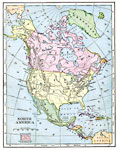
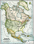
North America, 1906
A map from 1906 of North America showing the Dominion of Canada, Greenland or Danish America, the United States, Mexico, Guatemala, British Honduras (Belize), San Salvador (El Salvador), Honduras, Nicaragua, Costa Rica, and the islands of the Caribbe...

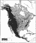
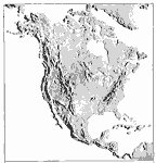
Relief of North America, 1906
A relief map from 1906 of North America, Central America, Greenland, and the Caribbean to Puerto Rico showing the general highlands and plains of the region. The map is keyed to show land area elevations from sea level to above 12,000 feet. Major riv...

Mean Average Temperatures in North America, 1906
A map from 1906 of North America showing the mean annual isotherms of the region given in degrees Fahrenheit. "The climate of North America naturally varies greatly, depending on latitude, the general atmospheric circulation or direction of the ...

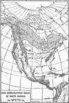
Zoögeographic Areas of North America, 1906
A zoögeographic map of North America and Central America from 1906 showing life zones of the region based on climate conditions. "Almost any given animal inhabits a more or less restricted geographic area, known as its "range," th...

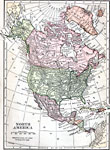
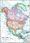
North America, 1906
A map from 1906 of North America, Central America, Greenland, and the Caribbean showing political boundaries at the time, major cities, mountain systems, rivers, and coastal features of the region. An outline map of Pennsylvania at the same map scale...

North America, 1909
A map from 1909 of North America and Central America, showing national borders at the time, major cities, railroads, mountain systems, lakes, rivers, and coastal features....

North America, 1909
A map from 1909 of North America, Central America, and the Caribbean showing political boundaries at the time, capitals and major cities, mountain systems, rivers, lakes, and coastal features....

Relief of North America, 1909
A base relief map from 1909 of North America, Central America, Greenland, and the Caribbean to Puerto Rico showing the general mountain systems, highlands, and plains of the region. Major river systems are shown....

North America, 1909
North America, with Central America included....

North America, 1910
A map from 1910 of North America showing the Dominion of Canada, Greenland, the United States, Mexico, Guatemala, British Honduras (Belize), San Salvador (El Salvador), Honduras, Nicaragua, Costa Rica, Panama, and the islands of the Caribbean includi...

First Previous Next Last


  Maps > North America > Complete Maps
Site Map  

Maps ETC is a part of the Educational Technology Clearinghouse
Produced by the Florida Center for Instructional Technology © 2009
College of Education, University of South Florida