|
|
|
| Maps > North America > Complete Maps |
Historic and contemporary maps of North America, including physical and political maps, early exploration maps, colonization period, Native American distribution, climate maps, relief maps, population density and distribution maps, vegetation maps, and economic/resource maps.

|
North America,
1910 |
|
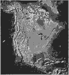
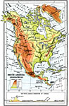
Relief Features of North America,
1910 |

|
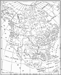
North American Population Density,
1910 |
|
Distribution of Fish in North America,
1910 |
|
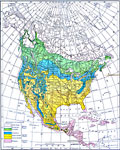
Climate and Life Provinces of North America,
1911 |

|
Köppen Climate Classification of North America,
1911 |
|
Southern Limit of Glaciation,
1911 |
|
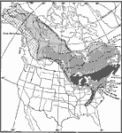
Conifers in Canada and Eastern United States,
1911 |
|
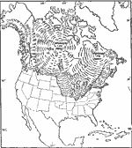
Orographical map of North America,
1911 |

|
North America, Vegetation,
1911 |
| First | Previous | Next | Last |
| Maps > North America > Complete Maps |
Maps ETC is a part of the Educational Technology Clearinghouse
Produced by the Florida Center for Instructional Technology © 2009
College of Education, University of South Florida