|
|
|
| Maps > North America > Regional Maps |
Regional maps of North America, which include several selections of countries and nations displaying physical and political features, economy, discovery, and more.
|
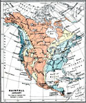
Rainfall in United States — January,
1915 |
|
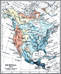
Rainfall in United States — July,
1915 |

|
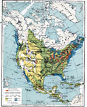
Vegetation of North America,
1915 |

|
Density of Population,
1915 |
|
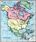
North America,
1915 |
|
Industry in North America,
1915 |

|
Economic Activity in United States and Canada,
1915 |

|
Granaries of the World,
1915 |

|
Fisheries,
1915 |
|
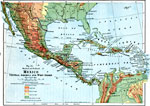
Central America,
1916 |
| First | Previous | Next | Last |
| Maps > North America > Regional Maps |
Maps ETC is a part of the Educational Technology Clearinghouse
Produced by the Florida Center for Instructional Technology © 2009
College of Education, University of South Florida