|
|
|
| Maps > United States > Civil War |
A collection of historic maps of the American Civil War, including regional seats of the war, battle and campaign maps, and territories held by Confederate and Union forces.
|
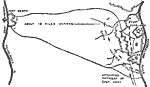
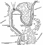
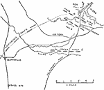
Forts Henry and Donelson,
February 1862 |
|
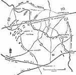
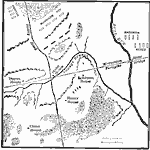
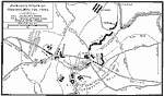
Gettysburg,
July 1, 1863 |
|
Gettysburg,
July 1863 |
|
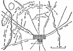
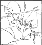
The First Battle of Bull Run,
July 21, 1861 |
|
First Battle of Bull Run,
July 21, 1861 |
|
Bull Run, Battle of the Afternoon,
July 21, 1861 |
|
Bull Run, Battle of the Forenoon,
June 21, 1861 |
|
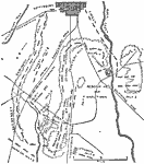
New Madrid and Island No. 10,
March 1862 |
|
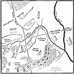
Battle of Pea Ridge,
March 1862 |
|
Jackson's Attack on Howard near Chancellorville,
May 1, 1863 |
| First | Previous | Next | Last |
| Maps > United States > Civil War |
Maps ETC is a part of the Educational Technology Clearinghouse
Produced by the Florida Center for Instructional Technology © 2009
College of Education, University of South Florida