|
|
|
| Maps > United States > Growth of Nation |
A collection of historic maps of territorial acquisitions and growth of the United States for use in the K-12 classroom.

|
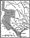
Texas Boundary Problem,
1845–1850 |

|
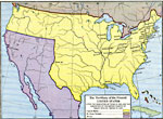
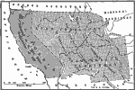
Territory Ceded by Mexico,
1845–1853 |
|
The Territory of the United States,
1845–1886 |
|
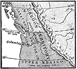
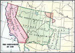
The Oregon Country,
1846 |
|
Dispute Between United States and Mexico,
1846 |
|
The Territory of the United States,
1846–1848 |
|
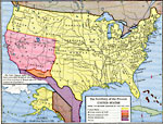
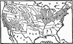
Compromise of 1850,
1850 |
|
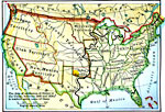
The United States,
1850 |
|
The Slavery Prohibition Compromise of 1850,
1850 |
|
Compromise of 1850,
1850 |
| First | Previous | Next | Last |
| Maps > United States > Growth of Nation |
Maps ETC is a part of the Educational Technology Clearinghouse
Produced by the Florida Center for Instructional Technology © 2009
College of Education, University of South Florida