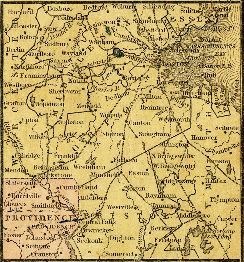
Description: A map from 1858 of the area immediately surrounding Boston, Massachusetts, and Providence, Rhode Island. The map shows cities and towns, railroads, and rivers.
Place Names: Massachusetts, United States, �Massachusetts, Rhode Island, Providence, Scituate, Salem, �Bosto
ISO Topic Categories: boundaries,
inlandWaters,
location,
oceans,
transportation,
utilitiesCommunication
Keywords: The Vicinity of Boston and Providence, physical, �political, �transportation, physical features, major political subdivisions,
county borders, railroads, boundaries,
inlandWaters,
location,
oceans,
transportation,
utilitiesCommunication, Unknown, 1858
Source: , Mitchell's School Atlas (Philadelphia, PA : E. H. Butler & Co., 1863)
Map Credit: Courtesy the private collection of Roy Winkelman |
|