Maps Site map
  Maps > United States > Massachusetts
Site Map  

  Record   1   to   10  of   113

A collection of historic and contemporary political and physical maps of Massachusetts, including early exploration and settlement maps, Revolutionary War maps, and automobile route maps.
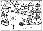
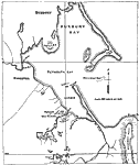
Port St. Louis or Plymouth Bay, 1613
A facsimile from a map by Samuel Champlain (1613) of the Plymouth Bay, here called Port St. Louis by Champlain, as explored by the French prior to the landing of the Pilgrims in 1620. The map is keyed to show (A) anchoring–place, (B) channel, (...

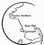
Plymouth, 1620
A sketch map of Massachusetts Bay showing the area of the Pilgrim landing on Cape Cod, settlement of Plymouth, and relative proximity to Boston Harbor....

Plymouth Harbor, 1620
A map of Plymouth Harbor showing the landing site of the Mayflower, the Plymouth Rock, and the earl settlement site of the Pilgrims....

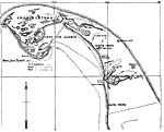
Pilgrim Arrival at Cape Cod Harbor, 1620
A map showing the Pilgrim activity upon arrival at Cape Cod Harbor on the ship Mayflower (November 15–17, 1620). "There were three expeditions from the ship. The women were set ashore to wash at (a), and while the carpenter was repairing t...

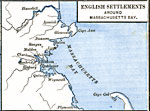
English Settlements around Massachusetts Bay, 1620–1652
A map of Massachusetts Bay showing the early English settlements from Plymouth to Haverhill on the Merrimac River....

Massachusetts Bay, 1667
"This is a fac–simile of a map of Boston Harbor and adjacent settlements in 1667, and is believed to be a specimen of the first engraving executed in America. Instead of the top of the map being north, according to the present method of dr...

Boston and its Environs, 1775
Boston and its environs....

Vicinity of Boston, 1775
A map of the vicinity of Boston in 1775 at the opening of the American Revolutionary War, showing Dorchester Heights, Boston, Charlestown, Bunker Hill, Lexington, and Concord....

Plan of the Siege of Boston, 1775
A plan of the siege of Boston showing the American fortifications around the harbor and British positions in Charlestown....

Boston and Neighborhood, 1775
A sketch map of Boston and vicinity showing important sites in 1775 during the opening stages of the American Revolutionary War, including Lexington, Concord, and Bunker Hill....

Next Last


  Maps > United States > Massachusetts
Site Map  

Maps ETC is a part of the Educational Technology Clearinghouse
Produced by the Florida Center for Instructional Technology © 2009
College of Education, University of South Florida