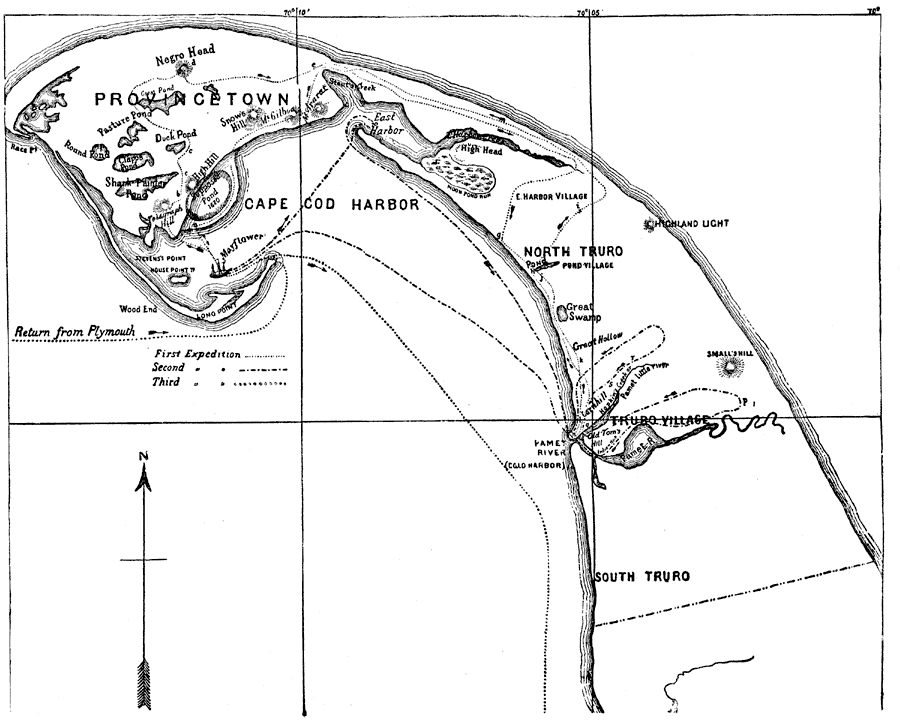
Description: A map showing the Pilgrim activity upon arrival at Cape Cod Harbor on the ship Mayflower (November 15–17, 1620). "There were three expeditions from the ship. The women were set ashore to wash at (a), and while the carpenter was repairing their shallop, Standish and sixteen men started on the 15th November (O.S.) on the first expedition. At (b) they saw some Indians and a dog, who disappeared in the woods at (c), and later ran up the hill at (d). The explorers encamped for the night at (e), and the next day, where they turned the head of the creek, they drank their first New England water. Then at (g) they built a fire as a signal to those on the ship. At (h) they spent their second night; at (j) they found plain ground fit to plough; at (k) they opened a grave; at (l) dug up some corn; at Pamet River they found an old palisade and saw two canoes. They then retraced their steps, and at (i) Bradford was caught in a deer–trap." — Winsor, 1884, pp. 270–271.
Place Names: Massachusetts, Cape Cod, �Provincetown, �Truco Village,
ISO Topic Categories: inlandWaters,
location
Keywords: Pilgrim Arrival at Cape Cod Harbor, physical, �historical, physical features, historical event, inlandWaters,
location, Unknown, 1620
Source: Justin Winsor, Narrative and Critical History of America Vol. III (Boston, MA: Houghton, Mifflin and Company, 1884) 270
Map Credit: Courtesy the private collection of Roy Winkelman |
|