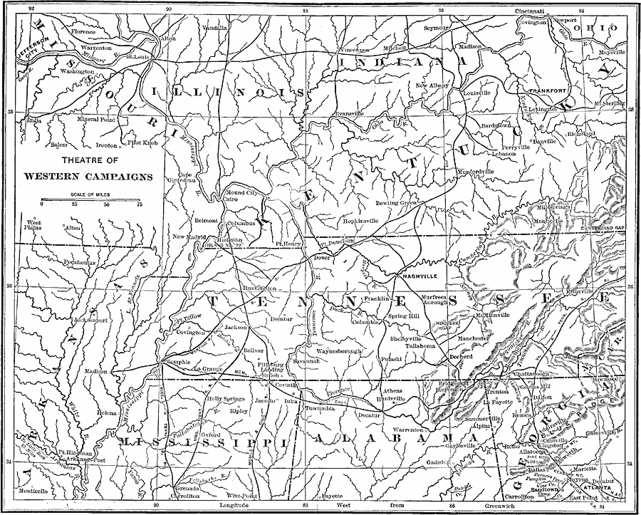
Description: A map showing the Theatre of Western Campaigns in the American Civil War. The map includes parts of the states of Missouri, Illinois, Indiana, Ohio, Kentucky, Arkansas, Tennessee, Mississippi, Alabama, Georgia, and North Carolina, and shows major cities, towns, and ports, railroads, mountain systems, and rivers.
Place Names: Civil War, Cincinnati, Knoxville, Manchester, Shelbyville, Athens, Atlanta, Rome, Marietta, Decatur, Monticello, Helena, Madison, Cairo, Columbus, Belmont, Washington, Pilot Knob, Bowling Green, Nashville, Louisville, Savannah, Memphis, Bolivar, Chattanooga, La F
ISO Topic Categories: inlandWaters,
location,
transportation,
boundaries
Keywords: The Theatre of Western Campaigns, physical, �political, �transportation, �historical, �theatre of western campaigns in the civil war, physical features, major political subdivisions, railroads, Civil War, inlandWaters,
location,
transportation,
boundaries, Unknown, 1861-1865
Source: Theodore Ayrault Dodge, A Bird's-Eye View of our Civil War (Boston, MA: Houghton, Mifflin and Company, 1897) 24-25
Map Credit: Courtesy the private collection of Roy Winkelman |
|