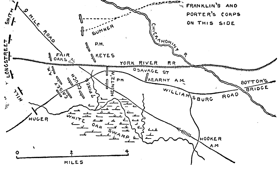
Description: A map of the area of the Battle of Fair Oaks, Virginia, which took place on May 31–June 1, 1862. The map shows the York River Railroad, Williamsburg Road, 9 Mile Road, the White Oak Swamp, the Chickahominy River, and the Union and Confederate positions.
Place Names: Civil War, Williamsburg, �Virgini
ISO Topic Categories: location,
inlandWaters
Keywords: The Battle of Fair Oaks, physical, �historical, kBattle, physical features, Civil War, location,
inlandWaters, Unknown, 1862
Source: Theodore Ayrault Dodge, A Bird's-Eye View of our Civil War (Boston, MA: Houghton, Mifflin and Company, 1897) 59
Map Credit: Courtesy the private collection of Roy Winkelman |
|