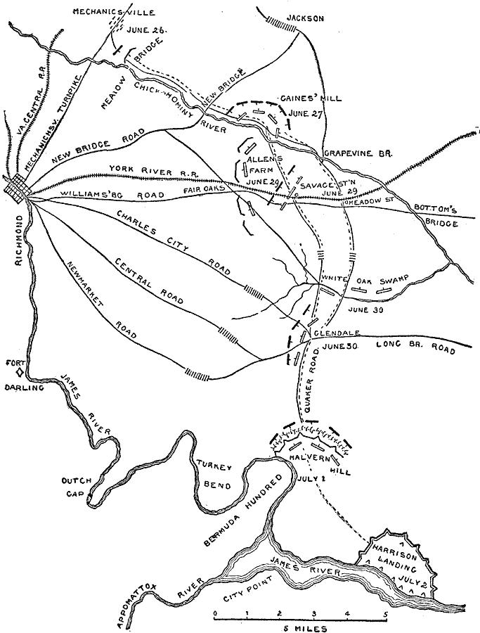
Description: A map of the area around Richmond, Virginia showing the sites of the Seven Days Battle, which took place June 26–July 2, 1862 during the American Civil War. The map shows the roads and railways to the east of Richmond, and the battle sites of Mechanicsville (June 26), Gains Mill (June 27), Allen's Farm (June 29), White Oak Swamp (June 30), Malvern Hill (July 1), and Harrison Landing on the James River (July 2).
Place Names: Civil War, Richmond, �Fort Darling, �Harrison Landing, �White Oak Swamp, �Caines' Mill, �Bottom's Bridge, �Dutch Gap, �Virgini
ISO Topic Categories: location,
inlandWaters,
transportation
Keywords: The Seven Days Battle, physical, �historical, �transportation, kBattle, physical features, roads,
railroads, Civil War, location,
inlandWaters,
transportation, Unknown, 1862
Source: Theodore Ayrault Dodge, A Bird's-Eye View of our Civil War (Boston, MA: Houghton, Mifflin and Company, 1897) 63
Map Credit: Courtesy the private collection of Roy Winkelman |
|