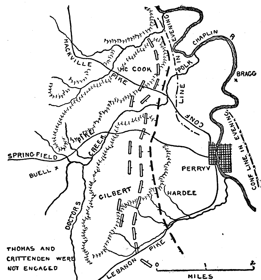
Description: A plan of the Battle of Perryville (Battle of Chaplin Hills), Kentucky, on October 8, 1862, at the end of the Confederate Heartland Offensive. The map shows the location of Perryville, the Chaplin River, Mackville Pike, Springfield Pike, Lebanon Pike, terrain features, the positions of the Confederate and Union armies, and the Confederate lines in the morning and in the evening.
Place Names: Civil War, Perryville, �Doctors Creek, �Pike Creek, �Springfield, �Mackville Pike,�Kentuck
ISO Topic Categories: location,
inlandWaters,
transportation
Keywords: Battle of Perryville, October 8, physical, �transportation, �historical, �thomas and crittenden were not engaged, confederate line in evening, kBattle, physical features, roads, Civil War, location,
inlandWaters,
transportation, Unknown, October 8, 1862
Source: Theodore Ayrault Dodge, A Bird's-Eye View of our Civil War (Boston, MA: Houghton, Mifflin and Company, 1897) 87
Map Credit: Courtesy the private collection of Roy Winkelman |
|