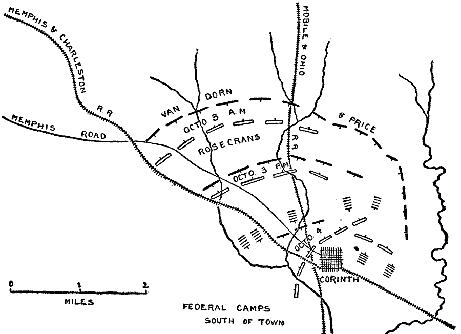
Description: A plan of the second Battle of Corinth (October 3–4, 1862), Mississippi in the American Civil War. The map shows Union and Confederate positions, the Memphis road, and the strategic railroads in the area.
Place Names: Civil War, Corinth, Memphis Road, Memphis And Charleston Railroad, Mobile And Ohio Railroa
ISO Topic Categories: inlandWaters,
location,
transportation
Keywords: Battle of Corinth, physical, �political, �historical, �transportation, �civil war battle of corinth mississippi, kBattle, physical features, roads,
railroads, Civil War, inlandWaters,
location,
transportation, Unknown, October 1862
Source: Theodore Ayrault Dodge, A Bird's-Eye View of our Civil War (Boston, MA: Houghton, Mifflin and Company, 1897) 91
Map Credit: Courtesy the private collection of Roy Winkelman |
|