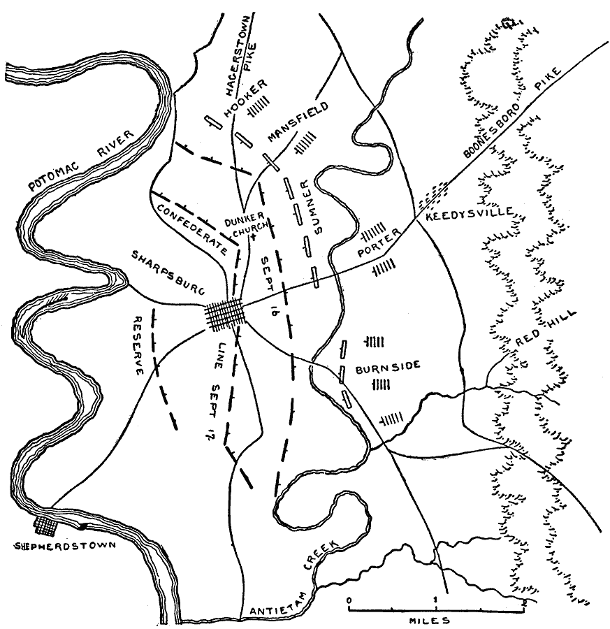
Description: A map of the vicinity of Sharpsburg, Maryland, site of the Battle of Antietam during the American Civil War (September 17, 1862). The map shows Union and Confederate troop positions over the course of the battle, Antietam Creek, and the Potomac River.
Place Names: Civil War, Shepherdstown, Sharpsburg, Potomac River, Antietam Creek, Boonesboro Pik
ISO Topic Categories: transportation,
location,
inlandWaters
Keywords: Sharpsburg, physical, �political, �transportation, �historical, �battle of antietam, battle of sharpsburg, dunkerchurch, sumner, mansfield, hooker, hagerstown pike, burnside, keedysville, kBattle, physical features, roads, Civil War, transportation,
location,
inlandWaters, Unknown, September 17, 1862
Source: Theodore Ayrault Dodge, A Bird's-Eye View of our Civil War (Boston, MA: Houghton, Mifflin and Company, 1897) 105
Map Credit: Courtesy the private collection of Roy Winkelman |
|