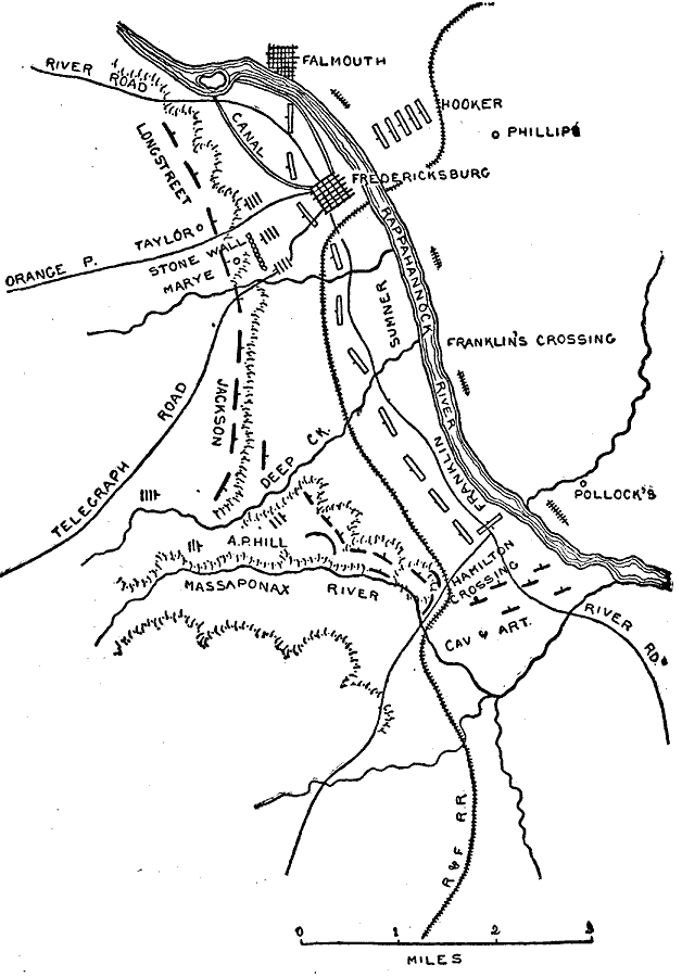
Description: A plan of the Battle of Fredericksburg, Virginia in the American Civil War.
Place Names: Civil War, Rappahannock River, River Road, R and F Railroad, Telegraph Road, Phillips, Falmouth, Pollock's, Fredericksbur
ISO Topic Categories: transportation,
location,
inlandWaters
Keywords: Fredericksburg, physical, �political, �transportation, �Longstreet, �Taylor, �stone wall, �Marye, �Jackson, �Massaponax River, �A.P. Hill, �cavalry and artillery, �Hamilton crossing, �Franklin's crossing, �Hooker, �Sumner, �historical, kBattle, physical features, roads, Civil War, transportation,
location,
inlandWaters, Unknown, December 13, 1862
Source: Theodore Ayrault Dodge, A Bird's-Eye View of our Civil War (Boston, MA: Houghton, Mifflin and Company, 1897) 113
Map Credit: Courtesy the private collection of Roy Winkelman |
|