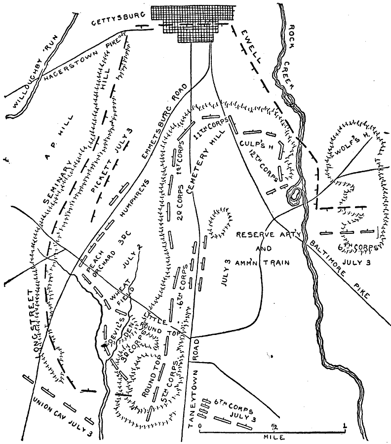
Description: A plan of the Battle of Gettysburg in the American Civil War. July 2, 3, 4 shown.
Place Names: Civil War, Gettysburg, Seminary Hill, A P Hill, Willoughby Run, Hagerstown Pike, Devil's Den, Wheat Field, Peach Orchard, Emmetsburg Road, Roundtop 5th Corps, 3d Corps, Cemetary Hill, Taneytown Road, 2d Corps, 1st Corps, Rock Creek, Baltimore Pike, Wolf's
ISO Topic Categories: transportation,
location,
inlandWaters
Keywords: Gettysburg, physical, �political, �transportation, �historical, �longstreet, 5th corps, 3rd corps, humphreys, pickett, 11th corps, culp's h, 12th corps, reserve art'y and amm'n train, 6th corps, ewell, kBattle, physical features, roads,
railroads, Civil War, transportation,
location,
inlandWaters, Unknown, July 1863
Source: Theodore Ayrault Dodge, A Bird's-Eye View of our Civil War (Boston, MA: Houghton, Mifflin and Company, 1897) 138
Map Credit: Courtesy the private collection of Roy Winkelman |
|