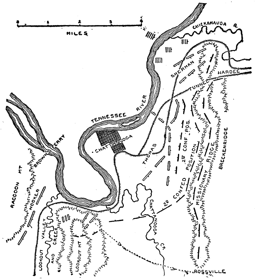
Description: The region surrounding Chattanooga, Tennessee. Site of the Battle of Chattanooga; November 23, 24, 25, 1863 shown.
Place Names: Civil War, Chattanooga, Tennessee River, Brown's Ferry, Raccoon Mountain, Lookout Valley And Creek, Lookout Mountain, Chattanooga Creek, Missionary Ridge, Chickamauga Rive
ISO Topic Categories: transportation,
location,
inlandWaters
Keywords: Battle of Chattanooga, physical, �political, �transportation, �historical, �american civil war, hooker, thomas, sherman, hardee, breckenridge, battle of chattanooga, kBattle, physical features, railroads, Civil War, transportation,
location,
inlandWaters, Unknown, November 1863
Source: Theodore Ayrault Dodge, A Bird's-Eye View of our Civil War (Boston, MA: Houghton, Mifflin and Company, 1897) 186
Map Credit: Courtesy the private collection of Roy Winkelman |
|