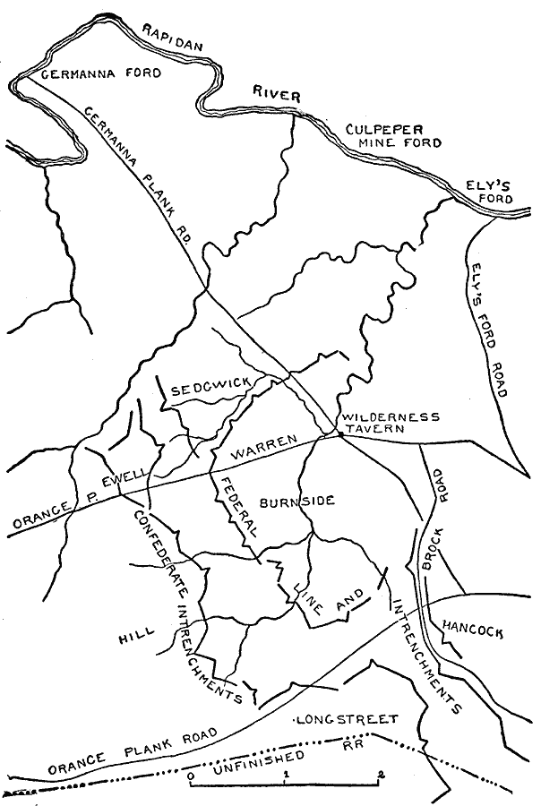
Description: A map of the region near Chancellorville, Virginia, site of the Battle of the Wilderness from May 5–6, 1864.
Place Names: Civil War, Germanna Ford, Rapidan River, Culpeper Mine Ford, Ely's Ford, Ely's Ford Road, Wilderness Tavern, Germanna Plank Road, Orange Pike, Orange Plank Road, Unfinished Railroad, Brock Roa
ISO Topic Categories: transportation,
location,
inlandWaters
Keywords: Battle of the Wilderness, physical, �political, �transportation, �historical, �american civil war, sedgwick, warren, burnside, confederate intrenchments, �Confederate entrenchments, longstreet, hancock, ewell, hill, kBattle, physical features, railroads,
roads, Civil War, transportation,
location,
inlandWaters, Unknown, May 1864
Source: Theodore Ayrault Dodge, A Bird's-Eye View of our Civil War (Boston, MA: Houghton, Mifflin and Company, 1897) 201
Map Credit: Courtesy the private collection of Roy Winkelman |
|