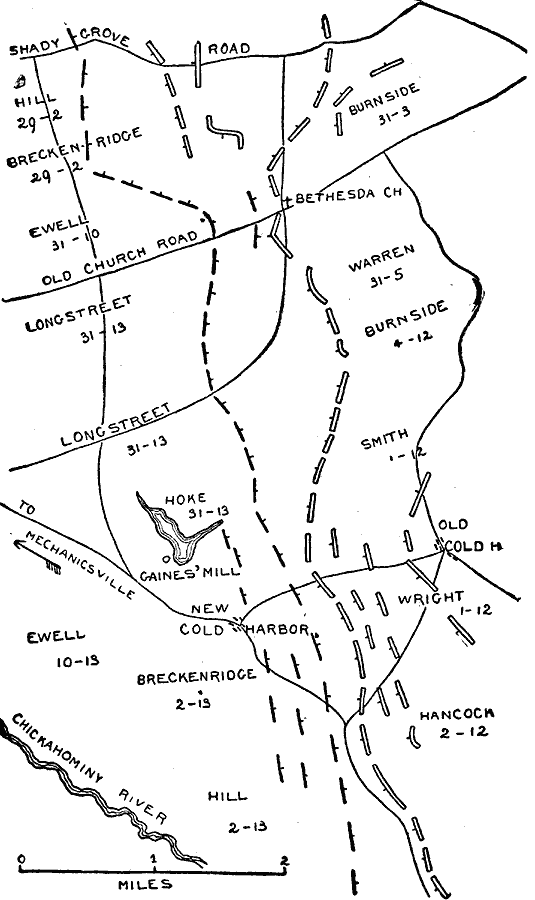
Description: A map of the region near Cold Harbor, Virginia, site of the Battle of Cold Harbor from May 31–June 12, 1864.
Place Names: Civil War, Chickahominy River, Old Church Road, Shady Grove Road, Bethesda Church, Gaines' Mill, New Cold Harbor, Old Cold Harbo
ISO Topic Categories: inlandWaters,
location,
transportation
Keywords: The Battle of Cold Harbor, physical, �political, �historical, �transportation, �american civil war, breckenridge, ewell, hancock, wright, smith, burnside, warren, longstreet, battle of cold harbor, kBattle, physical features, roads, Civil War, inlandWaters,
location,
transportation, Unknown, 1864
Source: Theodore Ayrault Dodge, A Bird's-Eye View of our Civil War (Boston, MA: Houghton, Mifflin and Company, 1897) 219
Map Credit: Courtesy the private collection of Roy Winkelman |
|