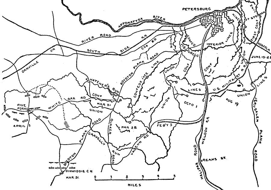
Description: A map of the region surrounding Petersburg, Virginia, site of the Battle of Petersburg and the Siege on Petersburg. Map shows June 1864–April 1865.
Place Names: Civil War, Petersburg, Appomattox River, River Road, Danville Or South Side Railroad, Five Forks, White Oak Road, Hatcher's Run, Boydton Plank Road, Quaker Road, Gravelly Run, Vaughn Road, Halifax Road, Drams Street, Weldon Railroad, Cox Road, Jerusalem Plank Roa
ISO Topic Categories: inlandWaters,
location,
transportation
Keywords: Operations around Petersburg, physical, �political, �historical, �transportation, �american civil war, dinwiddie, gregg, operations about petersburg, battle of petersburg, siege on petersburg, kBattle, physical features, roads,
railroads, Civil War, inlandWaters,
location,
transportation, Unknown, 1864–1865
Source: Theodore Ayrault Dodge, A Bird's-Eye View of our Civil War (Boston, MA: Houghton, Mifflin and Company, 1897) 249
Map Credit: Courtesy the private collection of Roy Winkelman |
|