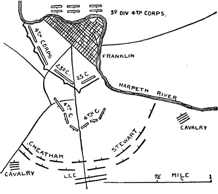
Description: A map of the vicinity of Franklin, Tennessee, site of the Second Battle of Franklin. The map shows Union and Confederate positions on November 30, 1864.
Place Names: Civil War, Harpeth River, Frankli
ISO Topic Categories: inlandWaters,
location,
transportation
Keywords: Second Battle of Franklin, physical, �political, �historical, �transportation, �american civil war, 4th corps, cheatham, lee, stewart, 3rd division 4th corps, 23rd company, 4th company, battle of franklin, kBattle, physical features, roads,
railroads, Civil War, inlandWaters,
location,
transportation, Unknown, November 30, 1864
Source: Theodore Ayrault Dodge, A Bird's-Eye View of our Civil War (Boston, MA: Houghton, Mifflin and Company, 1897) 294
Map Credit: Courtesy the private collection of Roy Winkelman |
|