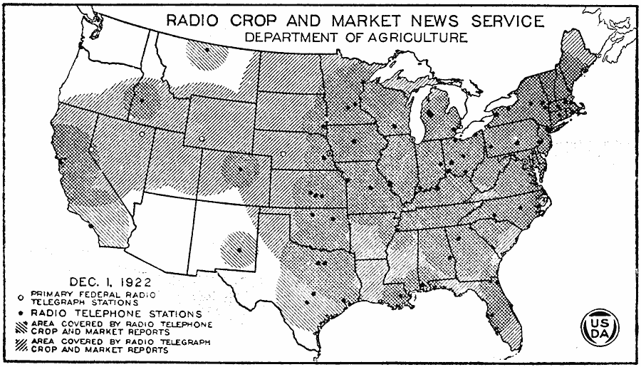
Description: A map of the United States from the U. S. Department of Agriculture (1922) showing the radio broadcast coverage areas for crop and market news reports as of December 1, 1922.
Place Names: Agriculture,
ISO Topic Categories: boundaries,
oceans,
utilitiesCommunication,
inlandWaters
Keywords: Radio Crop and Market News Service, physical, �political, �statistical, �radio crop and market news broadcast coverage area, primary federal radio telegraph stations, radio telephone stations, area covered by radio telephone crop and market reports, area covered by radio telegraph crop and market reports, kAgriculture, physical features, major political subdivisions,
country borders, boundaries,
oceans,
utilitiesCommunication,
inlandWaters, Unknown, 1922
Source: , United States Department of Agriculture Yearbook 1922 (Washington, DC: Government Printing Office, 1923) 22
Map Credit: Courtesy the private collection of Roy Winkelman |
|