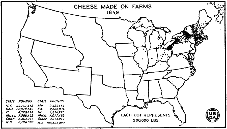
Description: A map of the United States from the U. S. Department of Agriculture (1922) showing the areas of the production of cheese made on farms by state in 1849. "Western New England, central and western New York and northeastern Ohio were the important cheese producing regions in 1849. Cheese production was the pioneer form of commercial dairying in the cooler climates. Dairies near large cities sold milk or butter." — United States Department of Agriculture Yearbook 1922, 1923.
Place Names: Agriculture, New York, Ohio, Vermont, Massachusetts, Connecticut, New Hampshire, Maine, Pennsylvania, Illinois, Michigan, �chees
ISO Topic Categories: boundaries,
inlandWaters,
farming,
economy
Keywords: Cheese Made on Farms in the United States, physical, �political, �statistical, �cheese made on farms, cheese production by state, kAgriculture, physical features, country borders,
major political subdivisions, agriculture,
economic, boundaries,
inlandWaters,
farming,
economy, Unknown, 1849
Source: , United States Department of Agriculture Yearbook 1922 (Washington, DC: Government Printing Office, 1923) 306
Map Credit: Courtesy the private collection of Roy Winkelman |
|