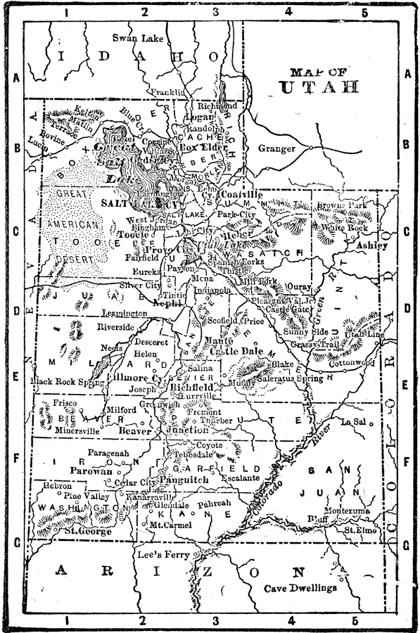
Description: A map from 1898 of Utah showing the capital at Salt Lake City, principal cities and towns, railroads, mountains, lakes, rivers, and the Great American Desert to the west of Salt Lake. "Settled 1848 at Salt Lake by Mormons from Illinois, under the leadership of Brigham Young. March, 1849, State of ‘Deseret’ organized. Congress refused to receive constitution adopted. Utah Territory organized September, 1850. Federal officers driven from Territory 1856. Troubles with Government till 1858." — Edison, 1898.
Place Names: Utah, Parowan, �St. George, �Salt Lake City, �Eureka, �Provo, �Ogde
ISO Topic Categories: boundaries,
inlandWaters,
location
Keywords: Utah, physical, �political, physical features, county borders, boundaries,
inlandWaters,
location, Unknown, 1898
Source: Thomas F. Edison, Edison's Handy Encyclopaedia of General Information and Universal Atlas (Chicago, IL: Laird and Lee, 1898) 497
Map Credit: Courtesy the private collection of Roy Winkelman |
|