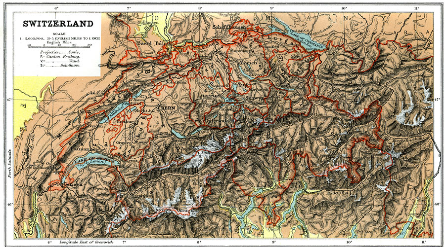
Description: A geo–political map of Switzerland that shows canton and country borders current to 1904, major cities, tunnels and railroad lines. Physical features such as mountain ranges with elevation measured in feet, glaciers, and major rivers. Generalized elevations shown as land below 1,000 feet colored light green, and land above 1,000 feet in elevation colored brown. Glaciers are left white.
Place Names: Switzerland, Basel, �Bern, �Chur, �Geneva, �Zurich, �Matterhorn, �Mont Blanc, ��Lausanne, �Lugano, �Fribour
ISO Topic Categories: boundaries,
elevation,
inlandWaters,
transportation
Keywords: Switzerland, physical, �political, �transportation, �Conic Projection, physical features,
topographical, country borders,
major political subdivisions, railroads, boundaries,
elevation,
inlandWaters,
transportation, Other, 1904
Source: Geo. G. Chisholm and C.H. Leete, eds., Longmans' New School Atlas (New York, NY: Longmans, Green, and Co., 1904) 23
Map Credit: Courtesy the private collection of Roy Winkelman |
|