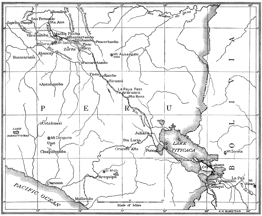
Description: A sketch map of southern Peru showing the route of the joint Yale University–National Geographic Society expedition of 1915, led by Hiram Bingham, the discoverer of Machu Picchu in 1911. This map shows the railroad from Mollendo on the Pacific Coast to Juliaca, the railroad from Puno on Lake Titicaca to Cuzco, the ferry route from Puno across Lake Titicaca to Copacabana, Bolivia and railroad to La Paz, and the towns along the Brigham route of exploration northwest of Cuzco. This map shows major towns and villages, rivers, lakes, and prominent mountain peaks of the area.
Place Names: Peru, Abancay, �Bolivia, �Cuzco, �Lake Titicaca, �La Paz, �Pacific Ocean, �Peru, �South America, �Urubamb
ISO Topic Categories: oceans,
location,
inlandWaters
Keywords: Sketch Map of Southern Peru, discovery, �exploration, �historical, �physical, �political, �prehistoric, �physical features, country borders, oceans,
location,
inlandWaters, Unknown, 1915
Source: Gilbert H. Grosvenor, ed., The National Geographic Magazine An Illustrated Monthly (Washington, DC: Judd & Detweiler Inc. , 1916) 434
Map Credit: Courtesy the private collection of Roy Winkelman |
|