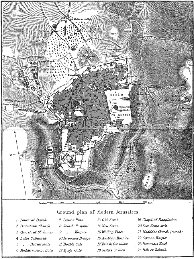
Description: A plan from 1903 for city of modern Jerusalem, showing prominent churches, hospitals, and religious monuments. The map shows the Armenian Quarter, Jewish Quarter, Moslem Quarter, and Christian Quarter of the city within the walls, surrounding terrain and sites, and is keyed to show important locations of the area.
Place Names: Israel, Damascus, �Jerusalem, �Kalat Jelad, �Neby Daud, �Siloam,
ISO Topic Categories: oceans,
location,
inlandWaters
Keywords: Jerusalem, physical, �political, �transportation, physical features, county borders, roads,
water routes, oceans,
location,
inlandWaters, Unknown, 1903
Source: Spencer Baynes, LL.D., and W. Robertson Smith, LL.D., eds., The Encyclopedia Britannica vol. 13 (New York, NY: The Werner Company, 1903) plate X
Map Credit: Courtesy the private collection of Roy Winkelman |
|