|
|
|
| Maps > Asia > Israel |
A collection of historic and contemporary political and physical maps of Israel, including significant Holy Land sites, for use in the K-12 classroom.

|
Cross–Section of the Dead Sea,
1881 |

|
Sea of Gennesareth or Galilee,
1881 |
|
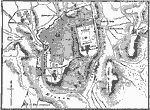
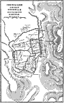
Jerusalem,
1881 |
|
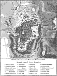
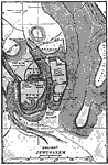
Jerusalem,
1903 |
|
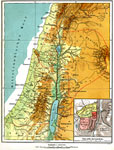
Holy Land,
1910 |
|
Palestine, with detail of Old Jerusalem,
1915 |
|
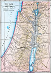
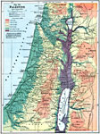
Palestine,
1916 |

|
Land of the Hebrews,
971–931 BC |
|
Ancient Jerusalem,
Around AD 100 |
|
Jerusalem in Nehemiah's Time,
Around AD 35 |
| Maps > Asia > Israel |
Maps ETC is a part of the Educational Technology Clearinghouse
Produced by the Florida Center for Instructional Technology © 2009
College of Education, University of South Florida