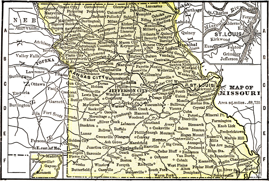
Description: A map from 1904 of Missouri showing the capital of Jefferson City, major cities and towns, railroads, and rivers. An inset map details St. Louis. "Missouri — Organized as a Territory in 1812; admitted to the statehood in 1821. Its lead mines had attracted attention as early as 1720. Area, 69,415 square miles; population, 3,153,000. Slaughtering and meat packing are the most important industries. The manufacture of tobacco ranks second. Large and extensive wheat fields in the State. Ranks ninth in wealth, nineteenth in square miles, thirteenth in iron, and seventeenth in tobacco. The Governor receives a salary of $5,000." — Wark 1904.
Place Names: Missouri, Jefferson, �St. Louis, �Springfield, �Kansas Cit
ISO Topic Categories: society,
transportation
Keywords: Missouri, physical, �political, �transportation, physical features, major political subdivisions, railroads, society,
transportation, Unknown, 1904
Source: Henry Wark, ed. , Wark's Modern Educator (New York, NY: Henry Wark, 1904) 877
Map Credit: Courtesy the private collection of Roy Winkelman |
|