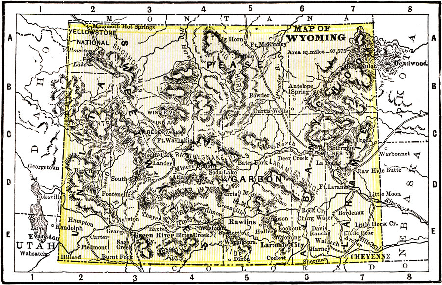
Description: A map from 1904 of Wyoming showing the capital, Cheyenne, counties and county seats, principal cities and towns, railroads, mountains, and rivers. "Wyoming has an area of 90,890 square miles, and a population of 92,531. First settlement made in 1834. The Territory was admitted to the Union in 1890. Wyoming is a stock–raising and mining State. Iron ore and petroleum are found plentifully. Capitol is Cheyenne. The Governor receives a salary of $2,500." — Wark 1904.
Place Names: Wyoming, Rawlins, �Cheyenne, �Carbon, �Pease, �Sweetwater, �Larami
ISO Topic Categories: transportation,
society
Keywords: Wyoming, physical, �political, �transportation, physical features,
topographical, major political subdivisions,
county borders, railroads, transportation,
society, Unknown, 1904
Source: Henry Wark, ed. , Wark's Modern Educator (New York, NY: Henry Wark, 1904) 881
Map Credit: Courtesy the private collection of Roy Winkelman |
|