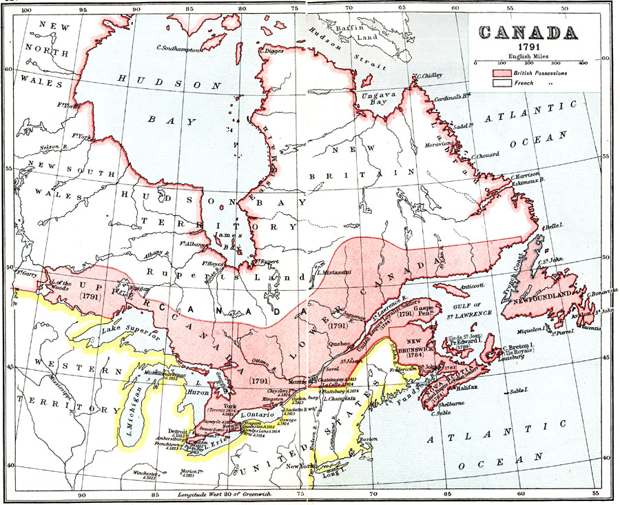
Description: A map of eastern Canada in 1791 after the American Revolution, during the formation of British North America and the division of Quebec into the largely French–speaking Lower Canada and the Loyalist Upper Canada. The map is color–coded to show French possessions at the time, and British possessions, including the coastal regions of the Hudson Bay and Labrador. The map shows major cities, settlements, forts and outposts, and battle sites during the French and Indian Wars. The map shows the territories of the United Empire Loyalist Settlers (1784) on the southern side of the St. Lawrence River, Gaspé Peninsula, New Brunswick, Nova Scotia, Prince Edward Island, and Cape Breton, with the former French place names in parentheses. The map also shows the territories of New North Wales, New South Wales, Hudson Bay Territory, Ruperts Land, New Britain, East Main along the Hudson Bay, and Labrador.
Place Names: Canada, Quebec, �New Brunswick, �Newfoundland, �Lower Canada, �Upper Canada, �New Britain, �New South Wale
ISO Topic Categories: society,
boundaries
Keywords: British Canada, political, �physical, �historical, physical features, society,
boundaries, Unknown, 1791
Source: Ernest Rhys, Ed., A Literary and Historical Atlas of North & South America (New York, NY: E.P. Dutton & CO., 1911) 12
Map Credit: Courtesy the private collection of Roy Winkelman |
|