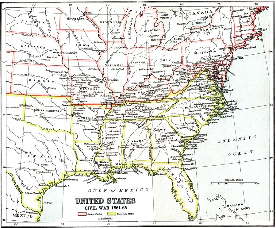
Description: A map of the eastern United Stated during the American Civil War (1861–1865). The map is color–coded to show the Union States, and the Secession States of the Confederacy. The map shows major cities and towns, railroads, rivers, and marks significant battlefields.
Place Names: Civil War, Washington D.C., �New York, �New Orleans, �Chicago, �Boston, �Philadelphia, �Harrisburg, �Columbia, �Columbus, �Confederate territor
ISO Topic Categories: structure,
boundaries
Keywords: United States Civil War, physical, �political, �historical, physical features, Civil War, structure,
boundaries, Unknown, 1861–1865
Source: Ernest Rhys, Ed., A Literary and Historical Atlas of North & South America (New York, NY: E.P. Dutton & CO., 1911) 16
Map Credit: Courtesy the private collection of Roy Winkelman |
|