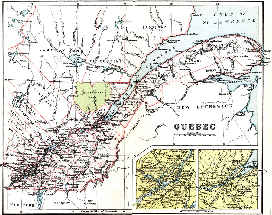
Description: A map from 1911 of the populous portion of the province of Quebec along the St. Lawrence River to the Gaspé Peninsula, including the southern portions of the counties Saguenay, Chicoutimi, and Lake St. John. This map shows county boundaries, the boundary of the Laurentides Park, major cities, towns, and ports, railways, the mountains south of the St. Lawrence River, lakes, rivers, and coastal features of the area. Two inset maps detail the vicinity around Montreal and the City of Quebec.
Place Names: Canada, Quebec, �Montrea
ISO Topic Categories: society
Keywords: Province of Quebec, physical, �political, physical features,
topographical, country borders,
major political subdivisions,
county borders, society, Unknown, 1911
Source: Ernest Rhys, Ed., A Literary and Historical Atlas of North & South America (New York, NY: E.P. Dutton & CO., 1911) 46
Map Credit: Courtesy the private collection of Roy Winkelman |
|