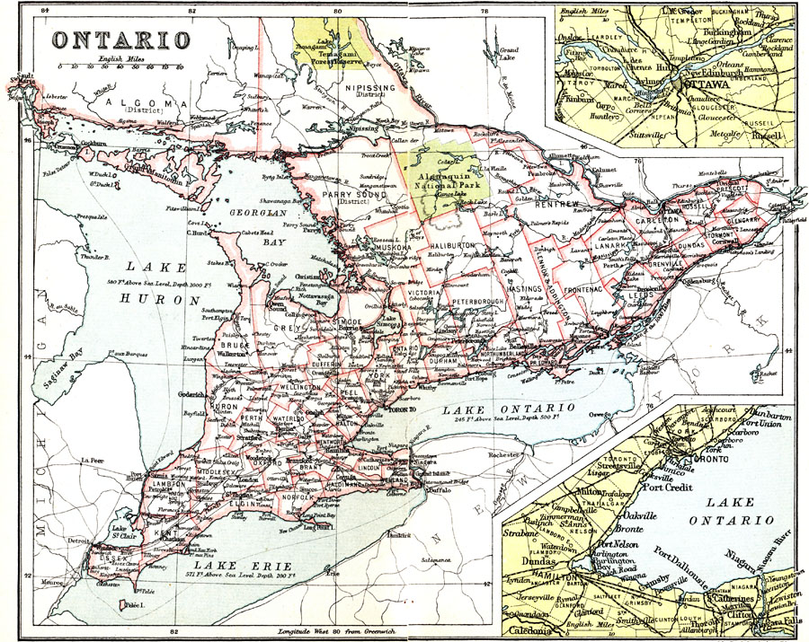
Description: A map from 1911 of the southern part of Ontario from the Algoma and Nipissing districts south to the Great Lakes and St. Lawrence River. The map shows district and county boundaries, major cities and towns, forest reserves, the Algonquin Provincial Park, railways, rivers, lakes, and shoreline features of the province. Two inset maps detail the areas of Ottawa and vicinity, and the western end of Lake Ontario near Toronto, Hamilton and the Niagara River.
Place Names: Canada, Ottawa, �Toront
ISO Topic Categories: society
Keywords: Ontario, political, �physical, physical features, major political subdivisions,
county borders, society, Unknown, 1911
Source: Ernest Rhys, Ed., A Literary and Historical Atlas of North & South America (New York, NY: E.P. Dutton & CO., 1911) 48
Map Credit: Courtesy the private collection of Roy Winkelman |
|