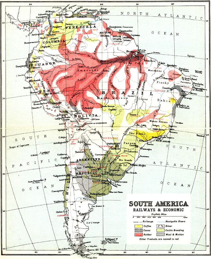
Description: A map from 1911 of South America showing the primary railways, navigable rivers, and local economic resources. The map is keyed to show regions of coffee, cocoa, rubber, wool and mutton production, cattle breeding, and silver mining, with notation of other products given in red.
Place Names: A Complete Map of South America, Argentina, �Bolivia, �Brazil, �Chile, �Columbia, �Ecuador, �Paraguay, �Peru, �Uruguay, �Venezuel
ISO Topic Categories: transportation,
society,
economy
Keywords: Railways and Economic Regions of South America, statistical, �transportation, kEconomic, economic, railroads,
water routes, transportation,
society,
economy, Unknown, 1911
Source: Ernest Rhys, Ed., A Literary and Historical Atlas of North & South America (New York, NY: E.P. Dutton & CO., 1911) 86
Map Credit: Courtesy the private collection of Roy Winkelman |
|