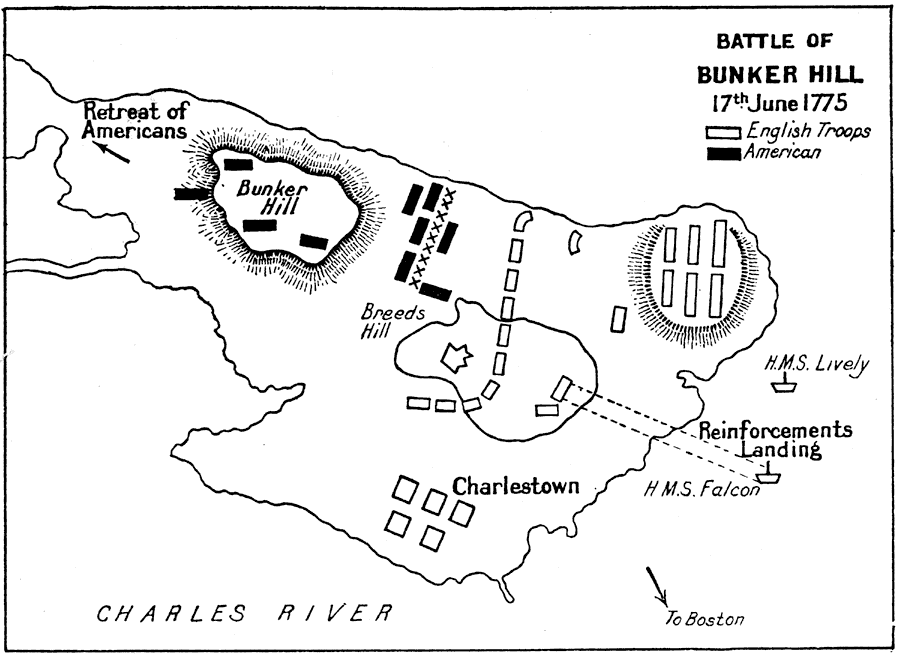
Description: A plan of the Battle of Bunker Hill on the Charlestown peninsula of Boston Harbor on June 17, 1775. The map shows the American and British troop positions, the confrontation on Breed's Hill, the reinforcement landing of the British, and the retreat route of the Americans.
Place Names: Massachusetts, Bunker Hill, �Bosto
ISO Topic Categories:
Keywords: Battle of Bunker Hill, historical, kAmericanRevolution, kBattle, American Revolution, Unknown, June 17, 1775
Source: Ernest Rhys, Ed., A Literary and Historical Atlas of North & South America (New York, NY: E.P. Dutton & CO., 1911) 117
Map Credit: Courtesy the private collection of Roy Winkelman |
|