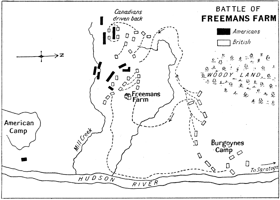
Description: A plan of the Battle of Freeman's Farm (September 19, 1777), also known as the First Saratoga, fought between the British army under John Burgoyne and the Americans under Horatio Gates and Benedict Arnold during the American Revolutionary War. The map is oriented with north to the right, and shows the Hudson River, the American camp and Burgoyne's camp, the site of Freeman's Farm, and the positions and movements of the opposing armies.
Place Names: Early America 1400-1800, New York, �Saratoga, �Hudson River, �American Revolutio
ISO Topic Categories:
Keywords: Battle of Freemans Farm, historical, kAmericanRevolution, kBattle, American Revolution, 1777
Source: Ernest Rhys, Ed., A Literary and Historical Atlas of North & South America (New York, NY: E.P. Dutton & CO., 1911) 119
Map Credit: Courtesy the private collection of Roy Winkelman |
|