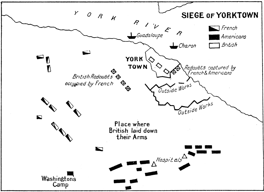
Description: A battle plan of the Siege of Yorktown of 1781 at the close of the American Revolutionary War. The plan shows the British fortifications around Yorktown, the ships Guadeloupe and Charon in the York River, the British redoubts occupied by the French, Washington's camp, field hospitals, the French and American positions, and the place where the British under Cornwallis laid down their arms in surrender.
Place Names: Early America 1400-1800, Yorktown, �American Revolutio
ISO Topic Categories:
Keywords: Siege of Yorktown, historical, kAmericanRevolution, kBattle, American Revolution, Unknown, 1781
Source: Ernest Rhys, Ed., A Literary and Historical Atlas of North & South America (New York, NY: E.P. Dutton & CO., 1911) 120
Map Credit: Courtesy the private collection of Roy Winkelman |
|