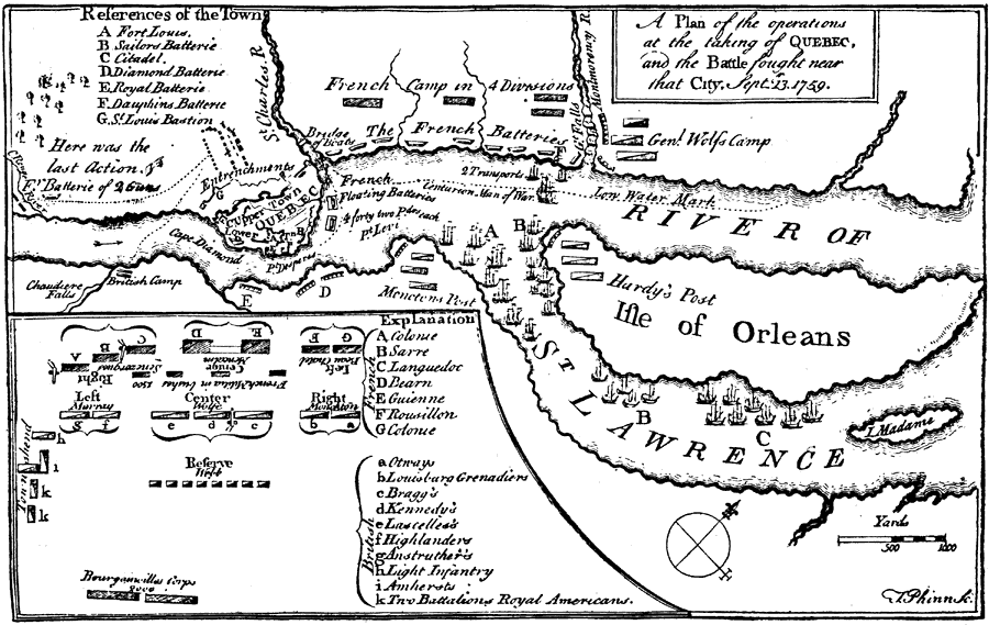
Description: A map of the vicinity of Quebec showing the plan of operations during the siege and capture of the city by the British in 1759. The map shows the city with its fortifications, the French camps and fortifications between the St. Charles River and Montmorency River, the British fleet positions, the British camps of Wolfe, Hardy, and Monckton, and an inset detailing the battle site on the Plains of Abraham (13 September, 1759), which resulted in the fall of Quebec.
Place Names: Canada, Quebe
ISO Topic Categories:
Keywords: The Taking of Quebec, historical, kBattle, kEarlyMapsFacsimile, American Revolution, Unknown, September 13, 1759
Source: Ernest Rhys, Ed., A Literary and Historical Atlas of North & South America (New York, NY: E.P. Dutton & CO., 1911) 122
Map Credit: Courtesy the private collection of Roy Winkelman |
|