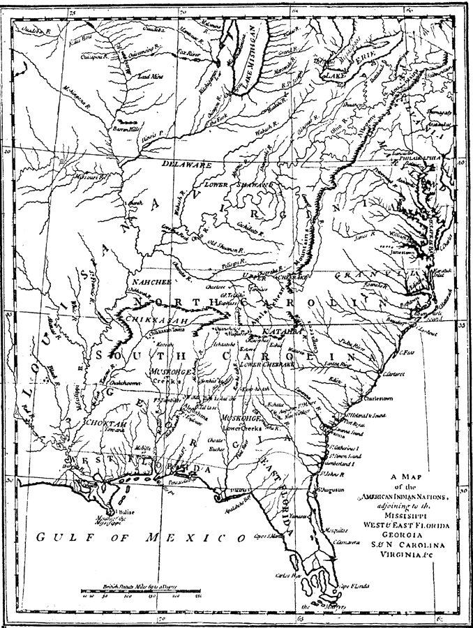
Description: An early map of the eastern North America from the Great Lakes to the Gulf of Mexico and east of the Mississippi River around 17765, showing the Indian Nations adjoining to the Mississippi, West and East Florida, Georgia, South and North Carolina and Virginia at the time. The map shows colonial boundaries extending from the Atlantic coast to the Mississippi River, towns, forts, native villages, mountain systems, and rivers.
Place Names: Early America 1400-1800, Delaware, �North Carolina, �South Carolina, �Georgia, �East Florida, �West Florida, �Native American
ISO Topic Categories: structure,
inlandWaters
Keywords: The Indian Nations, physical, �historical, kNativeAmerican, physical features,
topographical, structure,
inlandWaters, Unknown, 1775
Source: Ernest Rhys, Ed., A Literary and Historical Atlas of North & South America (New York, NY: E.P. Dutton & CO., 1911) 126
Map Credit: Courtesy the private collection of Roy Winkelman |
|