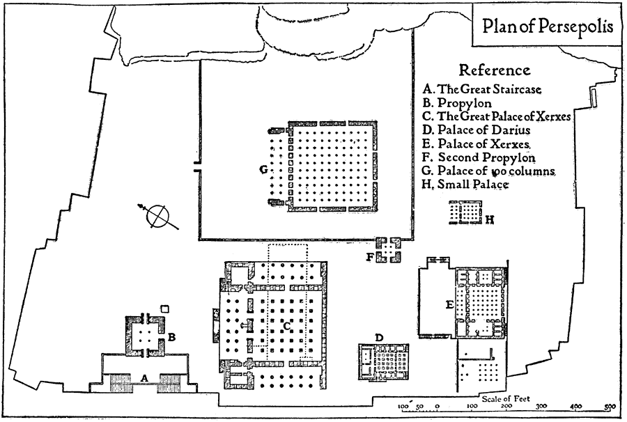
Description: A plan of Persepolis, near Shiraz, Iran, from the time of Darius I (549–486 BC) until the downfall of the Achaemenid dynasty (330 BC). This is an example of Persian architecture of the time. "The plan shows the general configuration of the platform on which the palaces of Persepolis are built, which covered an area of about1,600,000 sq. ft. The principal approach to it was at the north–west end." — The Enctclopædia Britannica, a Dictionary of Arts, Sciences, Literature and General Information, 1910.
Place Names: Iran, Plan of Persepoli
ISO Topic Categories: structure
Keywords: Plan of Persepolis, historical, �architecture, kArchitecture, structure, Unknown, 513 BC
Source: , The Enctclopædia Britannica a Dictionary of Arts, Sciences, Literature and General Information Eleventh Edition Volume II Andros to Austria (New York, NY: The Encyclopædia Britannica Company, 1910) 376
Map Credit: Courtesy the private collection of Roy Winkelman |
|